
.jpg)


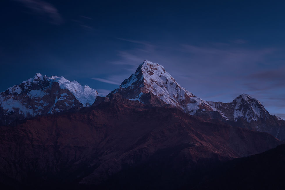
Stage 2 - Northern Alps
Savoie - Beaufortain - Vanoise

382 km
15 à 30 J
Distance
Dénivelé +
22.500 m
Duration


A crossing in the heart of the most beautiful mountain landscapes, in the center of the Alps.
Stage 2 of the HexaTrek is an immersion at the highest summits. Many glaciers, high mountain lakes and lots of cheese !
If the Northern Alps are known to all for their flourishing ski resorts, those who have taken the opposite route of visiting them in the summer season know a completely different side of this emblematic range.
THE HEART OF THE ALPS


THE CROSSING OF THE
HAUTE-SAVOIE
This region, even if it has never had a "Natural Park" label, is one of the most beautiful in France (according to the Savoyards).
The Mont-Blanc massif is not to be missed, the Aiguille du Midi and the surrounding glaciers are a must-see.
The Sixt-Fer-A-Cheval cirque with its thousands of waterfalls is also a must on the HexaTrek
NATIONAL PARK
LA VANOISE
The great crossing of the heart of the Vanoise via its glaciers is one of the most striking sections on the HexaTrek.
The Lac des Vaches, the Vallon de la Leisse, the Mont Pourri and other mythical peaks of the region will accompany you on this traverse.
MASSIF OF
Less well known than its neighbour, this massif is nevertheless one of the unmissable on the HexaTrek.
The Mont Thabor or the Lac des Cerces are simply sublime and offer an unforgettable experience of nature.
CERCES
USEFUL INFOS
Saisonalités, lieux de depart et arrivée, moyen de transport

The nearest airport to Le Lautaret is Grenoble
Geneva International Airport is the closest airport to the town of Yvoire.
Yvoire
Lautaret
Yvoire

Departure
Lautaret
Arrival
Jui - Oct
Season

To get to the **Col du Lautaret**, there is only one possibility apart from the car, it is **the bus line** (Bourg D'Oisans / Briançon)
Lautaret
Yvoire
From Geneva to Thonon-les-Bains, a bus line passes through the village of Yvoire several times a day.

Snow risks are high from October and before June.
Outside these periods, mountaineering equipment is mandatory.

Lautaret
The nearest train station is in Grenoble
From Nyon or Thonon-les-Bain, a ferry line serves the small village of Yvoire several times a day.
Yvoire
TOP 10 MOST BEAUTIFUL LANDSCAPE


ROSELEND LAKE
In this real postcard landscape, this lake reigns as the blue jewel in the heart of the green Beaufortain nature.
AIGUILLE DU MIDI
THE MONT BLANC

SIX-FER-A-CHEVAL
The Fer à Cheval cirque is the largest mountain cirque in the Alps. Surrounded by towering cliffs, the cirque is breathtakingly beautiful when the melting snow swells its waterfalls to majestic proportions.

EMOSSON LAKE
Magnificent place at the Swiss border, the small and big dam of Emosson are an unmissable part of the stage

PRESSET HUT
This refuge is located in an isolated site, marked by the presence of the Pierra Menta, dominated by the Aiguille de la Nova and the Pointe Presset
.jpeg)
POINTE DES CERCES
Culminating at an altitude of 3098 metres, the Pointe des Cerces is the emblematic summit of the Clarée. This great wild and technical ascent in the heart of the Cerces massif and its lakes, offers a 360° panorama

LA GRANDE CASSE
The highest peak in France's first national park, the Vanoise, the Grand casse est is a paradise for hikers and climbers.
VACHES LAKE
A beautiful lake surrounded by the highest peaks of the Vanoise national park. situated at an altitude of 2,318 metres, a pretty and historic flat stone path allows an unforgettable crossing.
LAC BLANC
A breathtaking view of the Mont Blanc massif.
Nestled in the heart of the Aiguilles Rouges in the Nature Reserve, this beautiful lake reigns at the centre of a splendid view of the Aiguilles de Chamonix.
Whether you're going for the big adventure, or just a section of the Hexatrek, discover the most beautiful landscapes of the route in pictures

DISCOVER THE OTHER STAGES
Vosges - Doubs - Jura


Stage 1 - The Great East
Discover the mystical landscapes of the Grand Est.
Between green forests and crystal clear waterfalls through the hidden treasures of Eastern France.
Distance
670 km
Elevation
21.200 m
20 à 35 J
Duration
Savoie - Beaufortain - Vanoise
Stage 2 - Northern Alps
Throughout the heart of the most beautiful mountain landscapes, hike and enjoy the beautiful vistas in the center of the exceptional Alps.
Distance
382 km
Elevation
22.500 m
15 à 30 J
Duration
Ecrins - Belledonne - Vercors

Stage 3 - Southern Alps
The Hautes-Alpes are a paradise for hikers who venture there. You will encounter magnificent natural areas at every corner.
Distance
497 km
Elevation
26.800 m
20 à 35 J
Duration
Cévennes - Tarn - Languedoc

Stage 4 - Gorges & Causses
Here, time and water have shaped the landscape and dug deep gorges. Creating high plateaux between the junctions of these rivers, this contrast offer HexaTrek hikers incredible views.
Distance
514 km
Elevation
14.300 m
15 à 25 J
Duration
Catalogne - Ariége - p.esp

Stage 5 - East Pyrenees
The itinerary of this stage crosses the borders continuously, between France, Andorra and Spain. You will remain in the heart of the Pyrenean range, close to the summits.
Distance
532 km
Elevation
30.600 m
25 à 35 J
Duration

